Canoe or SUP Milnerton Lagoon from Woodbridge Island: Launches, Tides, Rentals and Safety
A practical, scenic guide to paddling Milnerton Lagoon from Woodbridge Island: where to launch, when to go, rental options, permits and bird areas to avoid.
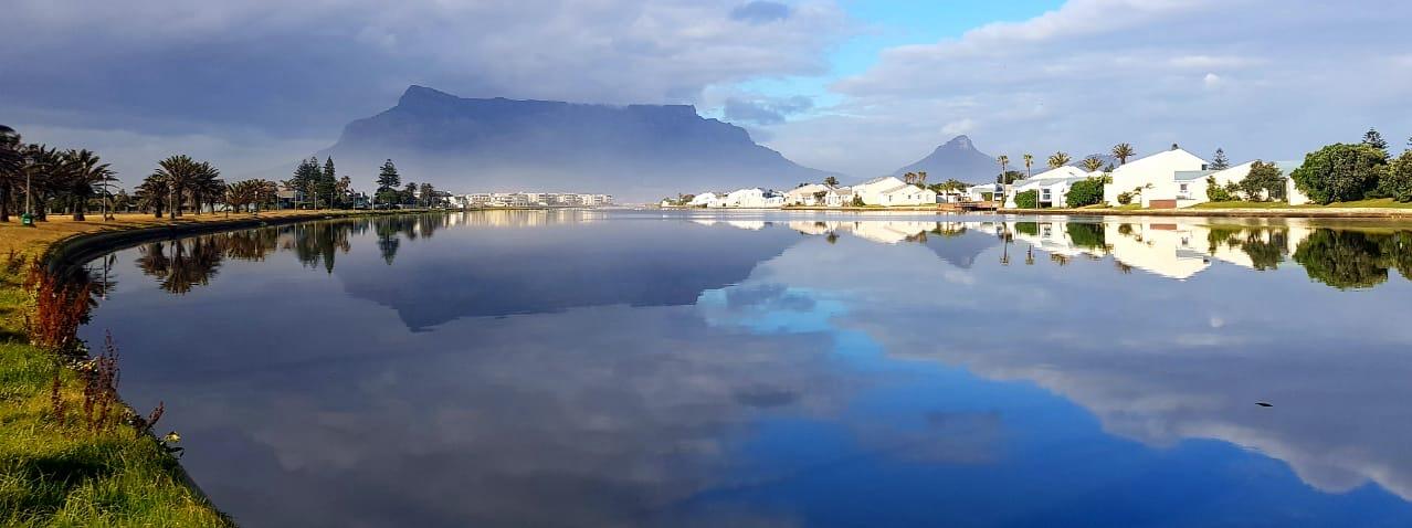
Milnerton Lagoon is one of Cape Town’s most photogenic flat‑water paddles. Set beneath the iconic lines of Table Mountain, the tidal lagoon curls past the Milnerton Lighthouse and the wooden heritage bridge that gives Woodbridge Island its name. On a still morning you can slide over mirror‑calm water, watch herons lift from the reeds and be back in time for brunch. This guide covers exactly how to plan it: launch points that don’t upset security, the best tides and winds, where to rent a board or boat, permit notes, and sensitive bird zones to give a wide berth.
Quick orientation: lagoon, island and mouth
• The lagoon is the tidal lower reach of the Diep River, flowing to the sea beside the Milnerton Lighthouse. It is brackish, shallow in places and subject to strong currents near the mouth on big tides.
• Woodbridge Island is a private residential complex linked to Milnerton by a modern road bridge and the restored wooden bridge (pedestrians only, a national heritage structure). Public access is along the Milnerton bank; the interior of the island is controlled by security.
• Expect calmest conditions around sunrise. Summer brings strong south‑easterlies by late morning; winter fronts bring north‑westerlies and rain that can raise flows and reduce water quality.
The best launch points (with parking and access notes)
1) Milnerton-side grass bank by the wooden bridge (recommended)
• Where: On the Milnerton mainland side, immediately upstream of the wooden bridge. Look for street parking along Woodbridge Drive and the small lawns that slope gently to the water.
• Why it’s good: Public access, a short carry, sandy/grass put‑in and quick access either upstream or towards the mouth.
• Notes: Do not use the wooden bridge itself to launch or tie up; it’s a protected structure and for pedestrians only. Keep gear out of sight in your car and lock up before you carry down.
2) Small sandy pocket near the modern road bridge
• Where: Also on the Milnerton mainland side, just downstream of the modern vehicle bridge, there are a couple of informal sandy pockets at low water.
• Why it’s good: Handy if the grass bank is busy. It puts you close to the inner lagoon for a short, scenic out‑and‑back.
• Notes: Watch for anglers and their lines. At very low tide these pockets can be muddy; footwear helps.
3) Island-side put‑ins (residents/guests only)
• Inside Woodbridge Island, some jetties and lawns touch the lagoon, but these are within a 24‑hour security complex. Access is for residents and registered guests; respect signage and guards. If you’re staying inside the complex, confirm where launching is allowed with the body corporate or your host.
4) The beach at the mouth (advanced only, ocean‑aware)
• You’ll see paddlers entering from the beach beside the lighthouse to surf skis or head offshore. This is not a beginner launch: there can be shorebreak, rip currents and a fast outflow on the ebb. If you do launch here on a SUP or kayak, choose small surf, go with experienced paddlers and stay well clear of the rip that forms along the rocks at low tide.
Three scenic paddle routes from Woodbridge Island
1) Bridge‑to‑Mouth Meander (about 2–3 km return; 30–60 minutes)
• Launch: Milnerton grass bank.
• Route: Head downstream toward the lighthouse, staying mid‑channel. Turn before the sandbar and any noticeable ocean pull at the mouth.
• Why: Big Table Mountain views, reflections on a high tide, and good for a short pre‑coffee glide.
• Watch for: Stronger current near the mouth on spring tides; fishermen on both banks.
2) Upstream Bridges & Reeds (about 4–6 km return; 60–90 minutes)
• Launch: Milnerton grass bank.
• Route: Paddle upstream under the wooden bridge and then the modern road bridge, following the bends until the lagoon narrows and reedbeds thicken. Turn at a convenient waypoint and cruise back with the tide.
• Why: Quieter water and frequent birdlife on the reed margins.
• Watch for: Sandbanks at low tide and submerged debris after…