Sunrise Run at Woodbridge Island: A Flat 5 km Loop Linking Lagoon, Bridges and Beach
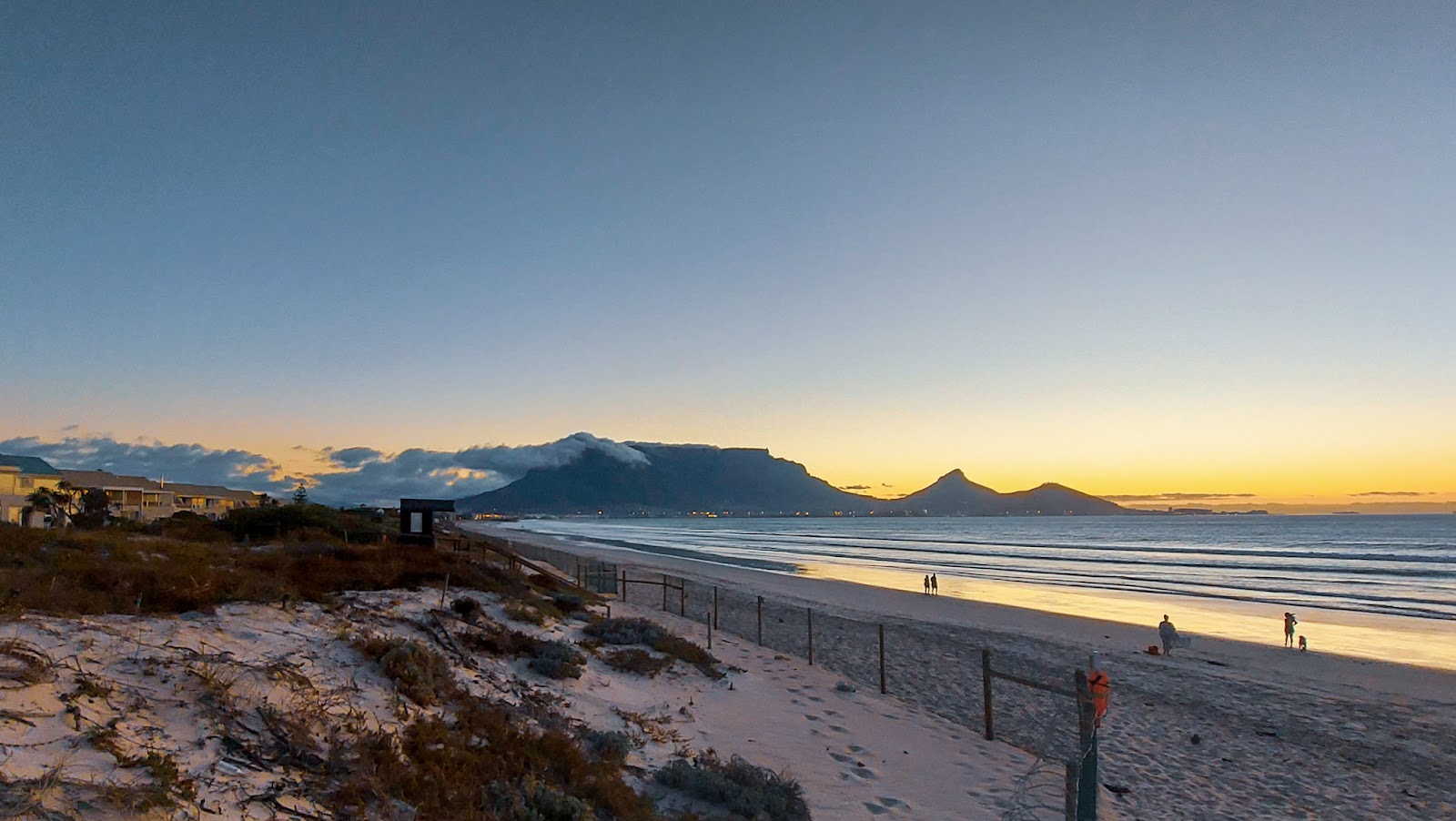
Chase first light on a scenic, nearly-flat 5 km that links Milnerton’s lighthouse, the wooden heritage bridge, a modern road bridge, and a firm-sand beach finish—plus a GPX you can load and go.
Why this sunrise run belongs on your Cape Town list
Woodbridge Island in Milnerton serves up one of Cape Town’s most photogenic short runs: Table Mountain glowing pink at dawn, the Atlantic sliding onto pale sand, and a calm lagoon flanked by a historic timber bridge and its modern counterpart. Better still, it’s flat, close to town, and easy to tailor for sand or pavement—so you can keep your cadence steady whether the tide is low and the beach is a ribbon of firm sand, or the wind is up and you’d rather stay sheltered along the lagoon.
This guide gives you everything you need to run it confidently at first light: a GPX-ready route, exact turn-by-turns, sand-versus-pavement choices, safety notes that reflect local realities, and reliable spots to grab coffee afterwards.
At a glance
• Distance: 5.0 km (low‑tide beach variant) or ~5.0 km (all‑pavement alternative)
• Elevation: Essentially flat
• Surfaces: Firm beach sand (optional), compact gravel, paving/boardwalk, bridge sidewalks
• Start/finish: Milnerton Lighthouse car park (free public lot)
• Best time: Sunrise (lighter wind, softer light, fewer beachgoers)
• Landmarks: Milnerton Lighthouse, Milnerton Lagoon, the restored wooden bridge (pedestrian‑only, heritage site), modern road bridge
• Amenities: No public water fountains on-route; bring your own bottle
• Swimming: Ocean is fine for a dip if conditions allow, but do not swim in the lagoon due to variable water quality
When to go: tide, wind and light
• Tide: Aim for low to mid‑tide if you want the beach leg. The sand is typically firm and fast then. At high tide or on stormy days, use the pavement variant below.
• Wind: Cape Town’s south‑easter can rise by mid‑morning. Sunrise windows are usually calmer.
• Light: First light makes Table Mountain pop across the bay and keeps the bridges quiet. Bring a small chest or headlamp if you’re starting pre‑dawn; switch it off once the horizon brightens.
• Safety note on water: The lagoon is a birding and paddling spot, but water quality can be inconsistent—skip lagoon swimming altogether and keep your dip to the open ocean if lifeguards and surf conditions look good.
Getting there
• By car/ride‑hail: Set “Milnerton Lighthouse Parking.” It’s just off Otto du Plessis Drive (M14). There’s usually space at sunrise.
• MyCiTi bus: Services along Marine Drive make this area reachable without a car; schedules vary by day—check times the day before and allow a short walk from the stop to the lighthouse.
• Note on access: Woodbridge Island’s residential streets are gated and private; all route options below stay on public beach, paths and bridge sidewalks—no estate access required.
The 5 km loop: turn‑by‑turn
Start/finish: Milnerton Lighthouse car park (approx −33.88970, 18.48360)
Low‑tide “beach finish” loop (recommended when sand is firm)
1) Lighthouse to lagoon path (0.4 km, paved/boardwalk): From the parking, jog east toward the lagoon mouth on the seaward promenade, then bear left to pick up the path along the lagoon’s western bank.
2) West bank to the wooden bridge (0.9 km, compact gravel/paving): Follow the quiet path upstream with the lagoon to your right. Birdlife is best in this stretch—keep an eye out for herons and terns.
3) Cross the wooden bridge (0.1 km, timber deck): This beautifully restored pedestrian bridge is the route’s namesake and a national heritage site—watch your footing if it’s wet.
4) East bank south to the modern bridge (0.6 km, paving): Turn right after the bridge and run downstream with the lagoon now on your right. You’ll soon see the modern road bridge ahead.
5) Cross the modern bridge back to the island side (0.2 km, sidewalk): Use the pedestrian walkway and enjoy a last look up the lagoon.
6) Bridge to beach access (0.4 km, pavement/boardwalk): From the western end of the bridge, angle toward the beach path behind the dunes; the lighthouse will be off to your left.
7) Beach spur to make up distance (1.2–1.6 km,…